Thursday, July 28, 2011

Guest post! - proposal by high school and college students.

Got an idea you want illustrated?  Email me!  Here's one just in: the First Submitted Redistricting Proposal by the Maximum Participation Minimum Deviation (MAPMINDs Coalition), a group of high school and college students. 

Green lines are their proposed boundaries, black dotted lines are 1986 boundaries.  

Sunday, July 17, 2011

Starting from the 1986 districts...

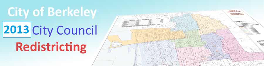
Let's start from the 1986 district boundaries, as the City Charter calls for.
Since Downtown has added lots of housing over the last quarter century, we need to move lots of people out of District 4.  Likewise, a boom in student housing construction, including several new high-rises near Telegraph, requires us to move lots of folks out of District 7.  
Other than that, the hillside districts need to gain people, while the western districts are about the right size.  District 3 is more or less fine as it is, with the current population inside the 1986 boundaries within 1% of one eighth of the city. 

Here's a mathematically elegant plan that starts from the 1986 boundaries and equalizes the population in six moves. 

Move A: District 1 needs 639 more people.  Conveniently, District 2 has 525 too many.  The first move has District 1 cross south of University one block between San Pablo and Sacramento.  This brings in more folks within walking distance of North Berkeley BART, which is near the population center of District 1.

Move B: After giving 686 people to District 1, District 2 now is short 161.  These will come from District 4, which has plenty to spare.  Two blocks near Dwight and Sacramento are chosen to keep District 4 as compact as possible. 

Move C: The biggest move is 1,822 people from District 4 into 5 near Cedar and MLK.  Since the council member of District 4 lives right near the 4-5 border, this move needs to sidestep that block and go further south, instead of just taking District 4's northern blocks.  A side benefit is it preserves the downtown corridor of Shattuck Ave. within District 4.

Move D: District 6 is limited in where it can expand: two of its neighbors, Districts 5 and 8, have no people to spare.  Further expansion into District 7 requires crossing the UC campus.  Fortunately, District 4 still has more residents to spare. 

Move E: Well, after the last 3 moves District 4 is actually short a few hundred.  These will have to come from District 7.  The two blocks near Bancroft and Ellsworth, closest to Downtown Berkeley BART, are selected.

Move F: Finally, District 8 needs about 900 folks from 7 to balance the two out.  To preserve District 7's integrity as the Telegraph Ave and student housing district, this move comes out of 7's southeast corner.


Thursday, July 14, 2011

Student Housing Communities

This map shades in blocks containing dorms, co-ops, fraternities, sororities, and other student housing communities.  Of course, there are students living elsewhere in town as well.

Tuesday, July 12, 2011

BART stations

BART stations with 5-10 minute walking radius.

Hilly areas

Areas where it's so hilly the streets don't meet at 4 way intersections.

Zoning Map overlay

Information from the zoning map.
Gray areas: commercial, high density residential, and multifamily residential
Yellow areas: Multiple family (2-4plexes) residential
Areas within dotted blue lines: single family residential

BUSD Diversity Areas

To keep our public schools diverse, BUSD uses a weighted index of income, race, and education attainment.

Racial map

Map showing approximate areas with large populations of certain races. 
Based on Eric Fisher's maps

Population Map - changes needed

Based on the 2010 census, current district populations range from 12,500 to 16,500 people.  Each district needs to be 14,000 - or on this map, 28 dots.

Population Map

Each dot represents about 500 people.  The stars, which represent where the current council member lives, counts as a dot as well and also represents 500 people, one of which is the council member.

1986 vs Current districts

Black lines are 1986 boundaries, Red lines are present boundaries.

1986 City Charter districts

One of the City Charter's criteria for new districts is that "Districts must adhere to the original (1986) boundaries as much as possible."

Map - Current Districts

Useful Links

City of Berkeley Redistricting Website
http://www.ci.berkeley.ca.us/ContentDisplay.aspx?id=55706

City of Berkeley Map Room
http://www.ci.berkeley.ca.us/ContentDisplay.aspx?id=55706

Berkeley Unified School District assignment districts page
http://www.berkeley.net/index.php?page=student-assignment-plan

Why Redistrict?

The latest 2010 Census shows that Berkeley has 112,000 residents, up from 100,000 in 2000.  Some council districts gained more people than others.  This means that district boundaries need to be redrawn so that each council member represents about the same number of people. 
More Info on the City of Berkeley Website.